“You can see the damage from space” 🌍 Satellite photos reveal something terrifying—our planet is visibly changing, and fast. From melting Arctic ice to vanishing glaciers and dried-up reservoirs, the Earth’s transformation over just a few decades is undeniable. These side-by-side images don’t just speak—they scream. See the most haunting comparisons in the article below 👇
Changes to our planet are no longer a distant theory—they’re visible from space. While conversations about environmental crises and climate disruption have been ongoing for years, satellite images captured by NASA offer undeniable proof of how human activity is reshaping Earth’s surface in just a few decades.
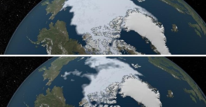
The Vanishing Arctic Ice
In two stark images—one from 1984 and the other from 2012—the dramatic retreat of Arctic ice is impossible to ignore. What was once a thick, expansive ice sheet has drastically thinned and receded, a clear signal of global warming in action. And the situation hasn’t improved—melting continues year after year.

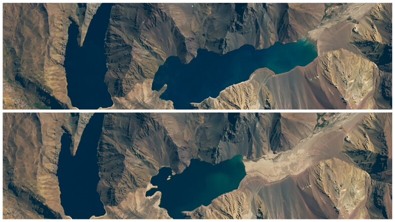
El Yeso Reservoir Dries Up
Once a crucial water source for Santiago, Chile, the El Yeso Reservoir has suffered a massive decline. In 2016, it held 219 million cubic meters of water. By 2020, that number dropped to just 99 million due to prolonged droughts—leaving the once-thriving reservoir a shadow of its former self.
The Cracking of the Thwaites Glacier
Known ominously as the “Doomsday Glacier,” Antarctica’s Thwaites Glacier is slowly disintegrating. Satellite images from 2001 and 2019 show the glacier shedding ice into the Amundsen Sea. As it breaks apart, the resulting sea level rise poses a global threat to coastal communities.

Reemergence of the Dolmen of Guadalperal
Spain’s Valdecañas Reservoir once hid an ancient monument beneath its waters. But as droughts worsened, the Dolmen of Guadalperal reappeared. A 2013 image shows it submerged, while by 2019, the stone structure was fully exposed due to falling water levels.

The Disappearance of the Ok Glacier
Iceland’s Ok volcano was once crowned by a thick glacier. Now, its icy peak is mostly gone. Images taken before and after 2019 show the glacier retreating so much that it now covers less than one square kilometer—a loss so significant that Iceland held a funeral for it.

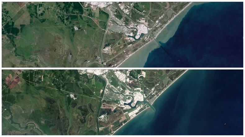
Eroding Coastline in Freeport, Texas
Along the Texas coastline near Freeport, erosion is eating away at the land. The shoreline has been shrinking by about 15 meters per year. Comparing images from 1986 and 2016 reveals just how much land has vanished in just three decades.
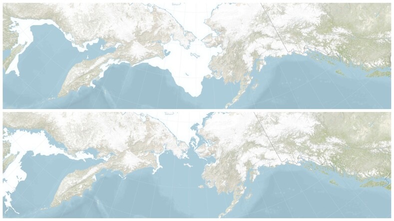
Bering Sea Ice Hits Record Low
Winter in the Bering Sea once meant thick ice coverage. But by 2018, satellite data showed a dramatic drop in ice extent compared to 2013. The ice that helps regulate global temperatures and sustain ecosystems is disappearing at an alarming rate.
These before-and-after photos aren’t just scientific data—they’re visual evidence of a planet in distress. They tell a story we can’t afford to ignore.
Have any of these changes surprised you? Which one shocked you the most? Share your thoughts in the comments.